Where are the Exuma Islands? The Bahamas. Rich in history, culture, heritage, and tranquil natural beauty, the Exuma Islands of the Bahamas calls to the connoisseurs of Caribbean island life, and those individuals who desire to retreat to a place that seemingly slows in time and offers up naturally wondrous untainted pieces of paradise. A […]
Discovery Map Series: Columbia River, Headwaters to the Pacific Ocean
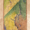
Columbia River Whether it is called the River Oregon, Big River, or River of the West, the Columbia River is the largest river in North America that drains into the Pacific Ocean. The Columbia River drains a basin that is approximately 260,000 square miles, from its headwaters in the Rocky Mountains of British Columbia, Canada […]
Travel Tuesday Map Series: Adirondack State Park, New York
Adirondack State Park New York Historic Map Art Wall Decor PosterBring in a Wonderful famous Print Poster like this Art Painted Print Poster is the best for discerning customers who demands the best fine artwork Printed wall decoration: This wall decor print poster has some size variations like (11*14, 16*20, 20*24, 24*30 & 36*45) that […]
Discovery Map Series: Portolan chart of the Mediterranean and Black Seas with the west coast of Spain and Portugal
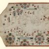
In early times, the Mediterranean Sea was the central point of transport, trade and cultural connection between North Africa, Western Asia and Southern Europe. The Italians, the Genoese and the Venetians, in particular, made their mark on the Mediterranean shores as traders. Sailing by way of the Mediterranean and Black Seas was essential to commerce […]
Discovery Map Series: Vintage Ireland Map
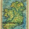
This gorgeous and easy to read map celebrates in hand painted splendor the beauty of the Irish Isle we all know and love. This map was restored and painted by a dedicated map restoration artist and makes a wonderful gift or memory of a beautiful country. Easy to read and brilliantly beautiful this map will […]
Discovery Map Series: Gooseberry Falls State Park, Minnesota
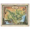
Gooseberry Falls State Park minnesota Historic Map Bring in a historical famous map like Great Lakes Minnesota Wisconsin Michigan Ohio Canada Map wall art print poster is the best for discerning customers who demand the best fine artwork printing wall decoration. * This wall decor print poster has some size variations like (11*14, 16*20, 20*24, […]
Our Most Popular Maps Make Great Christmas Gifts!
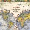
Fear not though my friends. I come with good tidings and great gift suggestions. If you have been reading our blog for the past few weeks, you know that our custom maps make great gifts. They are elegant, visually interesting and unique, just like their antique map counterparts. BUT they do not cost near as […]
Travel Tuesday Map Series: Lake Jocassee, South Carolina
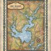
The Lake Jocassee region supports a diverse flora and fauna. Aquatic plants include alligatorweed, coon’s tail, waterweed, while common species of trees comprises bald cypress, water tupelo, red maple, sweetgum, water ash and water oak. An abundance of fish can be found in Lake Keowee, including carp, spotted sucker, redbreast sunfish, silver redhorse, spottail shiner, […]
Travel Tuesday Map Series: Lake Sunapee New Hampshire
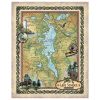
Lake Sunapee New Hampshire Historic Map There’s more to a lake than it simply being a body of water. Many lakes have helped to shape the vibrant history and culture of certain regions. Lakes provides environmental benefits, influence quality of life, strengthen economies through tourism, provide amazing opportunities for recreation and cottage/residential living, and serve […]
Discovery Map Series: The sites of Death Valley National Park, California
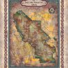
Straddling the California-Nevada border, Death Valley National Park occupies a desert valley area between the arid Great Basin and Mojave deserts. It is the hottest and driest place in America, and the lowest of all the national parks in the lower 48 states. Covering 3.3 million acres, this park features salt-flats, mysterious rocks, sand dunes, […]

Follow Us!