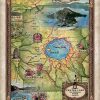
Another beautiful creation by Great River Arts!
Enjoy our archive of Lisa’s monthly newsletters

Another beautiful creation by Great River Arts!
Sign up for our weekly map give-away here! This week’s mystery winner is… peraltamandy5@ If your email address starts with “peraltamandy5″ please email me at: [email protected] to claim your free map! The entire email address has been omitted for your privacy. The name on this page is changed weekly, and chosen with random.org. Thank you […]
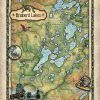
There’s more to a lake than it simply being a body of water. Many lakes have helped to shape the vibrant history and culture of certain regions. Lakes provides environmental benefits, influence quality of life, strengthen economies through tourism, provide amazing opportunities for recreation and cottage/residential living, and serve as a source of drinking water […]
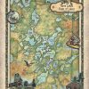
There’s more to a lake than it simply being a body of water. Many lakes have helped to shape the vibrant history and culture of certain regions. Lakes provides environmental benefits, influence quality of life, strengthen economies through tourism, provide amazing opportunities for recreation and cottage/residential living, and serve as a source of drinking water […]
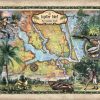
Immediately south of Jupiter Inlet Light in Palm Beach County, Florida is Jupiter Inlet, an opening in the beach, that leads to Jupiter Sound on the north, Loxahatchee River on the west, and Lake Worth Creek on the south. Fourteen miles south of St. Lucie Inlet, this turquoise runway to the Atlantic Ocean was originally […]
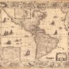
The America, Noviter Delineata map, published in 1622, is the work of Jodocus Hondius (1563-1612) and Jan Jansson (1588-1664). Jodocus Hondius, also called “the Elder,” was a Flemish cartographer and publisher, who made a name for himself in Ghent, where he worked as an engraver and globe maker. In 1584, Hondius fled to London during the Eighty […]
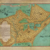
The story told is that upon returning to Montreal, Canada, following his exploration of the Great Lakes and the Mississippi River 1673-1674, with Jesuit missionary Jacques Marquette, Louis Joliet, at the request of French officials, drew from memory the “Nouvelle decouverte de plusieurs nations dans la Nouvelle France en l’année 1673 et 1674”, translated “New […]
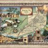
Santa Fe, New Mexico Santa Fe, meaning holy faith in Spanish, was founded between 1607 and 1610 by Spanish colonists, and is the highest in elevation and oldest state capital in the United States. At an altitude over 7,000 feet situated in the foothills of the southern Rocky Mountains, Santa Fe is New Mexico’s fourth […]
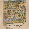
This pictorial and whimsical map illustration of New Mexico is believed to have its origin in a coloring book published in the 1950s. While the maker is unknown, the charm of this unique state map is obvious. It is a very detailed map, offering much knowledge into significant features of the State of New Mexico […]
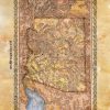
This is a historic railroad map of the proposed state, created in 1876, with the proposed state outlined in yellow.. However, it also shows us stage lines, roads, trails, a proposed mail route, and propose railroad lines in addition to those already existing. The mail route would open up future business and grease the wheels […]
Follow Us!