Archive | Featured Article

RSS feed for this section

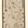
Discovery Map Series: Portolan Chart Of The Mediterranean And Connecting Seas 1550

07 Aug
portolean_chart_of_mediterreanean

It was in the year 1793 that Captain James Colnett of the Royal Navy set sail in the merchant ship Rattler to do a survey of the Galapagos Islands to investigate the possibilities of sperm-whale fisheries in the region. Colnett’s Chart of the Galapagos is the first fairly accurate map of the archipelago. It was […]

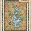
Travel Map Feature: Lake Norman, North Carolina

02 Aug
3.2 Travel Map

The Lake Norman region supports a diverse flora and fauna. Aquatic plants include alligatorweed, coon’s tail, waterweed, while common species of trees comprises bald cypress, water tupelo, red maple, sweetgum, water ash and water oak. An abundance of fish can be found in Lake Norman, including carp, spotted sucker, redbreast sunfish, silver redhorse, spottail shiner, […]

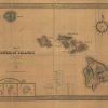
Discovery Map Series: Map Of The Hawaiian Islands 1876

31 Jul
hawaii_1876

Under the direction of William D. Anderson, Surveyor General of the Hawaiian Government Survey, Map of the Hawaiian Islands, 1876 was created and published for the celebration of the 100th anniversary of American independence by J. L. Smith Co. More specifically, it was for the Hawaiian Exhibit at the International Exhibition of Arts, Manufactures and Products […]

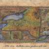
Discovery Map Series :1867 County Map of New York State

24 Jul
New_York

This county map of the state of New York by Samuel Augustus Mitchell is detailed out to the county level. Special attention is given to geographical features, towns, cities, and proposed railroads. The railroad was a major form of transportation during the time, and as such, new depots and railway lines were always in the […]

Discovery Map Series: 001 1737 Heirs Map of British North American Territories

17 Jul
2. Education

This map is a derivative work by Heir. It was taken from a British territories map produced by Herman Moll. Derivative works were common among cartographers. It was considered a sort of honor to have your work serve as the basis for future productions. It spoke to the accuracy and expert craftsmanship you had produced. […]

Discovery Map Series: 101 Oregon, Upper California and New Mexico 1849

10 Jul
1.0

This map is an example of Mitchell’s 1849 map of the West, at the time of the discovery of gold in California and immediate after the completion of Fremont’s final expedition. This is one of the best maps of the West of the era, reflecting the contemporary knowledge of the west. The California Gold Regions […]

Travel Tuesday Map Feature: Crystal Coast, North Carolina

28 Jun
Crystal-Coast

The Crystal Coast is an 85-mile stretch of coastline extending from the Cape Lookout National Seashore to southwestward to the New River, encompassing the entire area along the Bogue Banks, a barrier island that stretches for more than 20 miles. It is a mixture of colorful history, quiet stretches of beaches, quaint small towns, historic homes, picturesque […]

Discovery Map Series: Portolan Chart of Africa

26 Jun
3.1 Educational

In 1633, Pascal Roiz created the nautical chart titled by cataloger, A Portolan Chart of the Atlantic Ocean and Adjacent Continents. Pascoal Roiz was a Portuguese cartographer and portolan maker with origins in Lisbon and who was active during the 17th century. This historical portolan chart shows the Atlantic Ocean, southeast Pacific Ocean, the southwest […]