Sign up for our weekly map give-away here! This week’s mystery winner is… mikebarkhaus@ If your email address starts with “mikebarkhaus” please email me at: [email protected] to claim your free map! The entire email address has been omitted for your privacy. The name on this page is changed weekly, and chosen with random.org. Thank you […]
Archive | Featured Article
RSS feed for this sectionTravel Map Feature: Beaufort and the Sea Islands, South Carolina
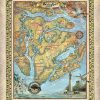
Discovered by Spanish Captain Pedro de Salaza in 1514, Beaufort is the second oldest city in South Carolina, behind Charleston, and is situated in the heart of the Sea Islands and South Carolina Lowcountry, on Port Royal Island. It was chartered by the British in 1711, and is known for its scenic location and for preserving a […]
Discovery Map Series: Africae Nova
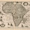
This mid-17th century map, Africae Nova Tabula, created by the Dutch cartographer Jodocus Hondius (1563-1612), is a beautiful decorative map of the continent of Africa, and was published in 1640 in Paris by Chez Iean Boisseau. Jodocus Hondius established himself as one of the most prominent geographers and engravers during the 17th century. Amsterdam was […]
Discovery Map Series: Portolan Chart Of The Mediterranean And Black Seas With The West Coast Of Spain And Portugal
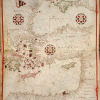
Titled “Portolan Atlas of the Mediterranean Sea, Western Europe and the Northwest Coast of Africa” by a cataloger, Catalan cartographer Joan Oliva is believed to be the mapmaker behind the creation of this portolan chart created in Italy in 1590. This chart, which represents the [Eastern Mediterranean] is one of five portolan charts in the […]
Travel Tuesday Map Feature: Paradise Valley, MT
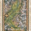
In southwestern Montana, just north of Yellowstone National Park and nestled between the Absaroka Range to the east and the Gallatin Range to the west is Paradise Valley. This Montana gem follows the Yellowstone River, and boasts 53 miles of breathtaking, scenic landscape, stretching through rich rolling farmland, hot springs, flowing crystal, clear rivers, acres […]
Discovery Map Series: Most Considerable Plantations of the English in America 1700
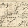
Originally produced in 1700 by cartographer Sutton Nicholls and “A New Map of the Most Considerable Plantations of the English in America” shows the English plantations in North America on a single sheet that encompasses five inset maps of Nova Scotia, Jamaica, Bermuda, Barbados, and the Carolinas. English mathematician and geographer professor at Oxford, England, […]
Tuesday Map Feature: Petoski Lakes, Beaver Island, And Traverse Bay Michigan
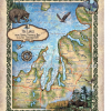
“Another Unsung Beauty by Lisa And Her Team”
Discovery Map series: The First Transcontinental Map of the U.S.
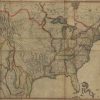
Regarded as one of the most significant maps of the 19th century, John Melish’s “Map of the United States of America: With the Contiguous British and Spanish Possessions, 1816,” depicts the United States extending from the Atlantic Coast to the Pacific Coast on the North American continent. It is said to be the first transcontinental […]
Travel Map Feature: Custom Travel Map of Jacksonville, Florida and The St. Johns River
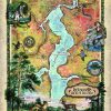
Called Jax by locals, Jacksonville is Florida’s most populous city, the largest city by landmass in the nation, and the fourth largest metropolitan area in the state. Jacksonville resides on the banks of the St. Johns River, about 25 miles south of the Georgia state line and 340 miles north of Miami. It is a […]
Travel Map Feature: 167 Colorado Highlights Custom Map
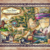
Colorado has the highest elevation of all the U.S. states, and it has some of the tallest mountain ranges in the U.S. as well. The state’s mountain scenery is arguably the most majestic and dramatic in the country. The State of Colorado was named after its great river the Colorado River, which Spanish explorers called […]

Follow Us!